What do street names tell us? Religiosity
Street names can tell us a lot about the history and culture of municipalities. In the article What do street names tell us?, we propose the use of the information contained in street names to measure cultural variables at the local level. This is based on a simple idea: the names of the streets are not random but represent cultural markers of a city and its history. They reflect the commemorative decisions of each municipality over time and, as such, can be understood as a “manifesto” about their cultural, social, and political values ( Rose-Redwood et al., 2009).
Departing from this insight and taking advantage of the possibilities of automatic text analysis allowed by data software, it is possible to measure certain cultural variables at the local level for all the municipalities in a region or a country. According to the Electoral Census Street Map, available on the Spanish Statistics Office website, the number of streets in Spain is almost 900,000 (January 2016) and on average their names consist of two words (excluding the word that defines the type of road, i.e. street, avenue, etc.). The five most frequent street names are Church (4,767 streets), Main (3,762), Fountain (2,544), Constitution (2,439), and Royal (2,208). Regarding the most frequent words in street names, “Saint” is by far the first (27,640), followed by others such as John (10,028), Saint (female) (9,968), Saint (in Catalan) (8,408), Joseph (8,043) and House (7,977).
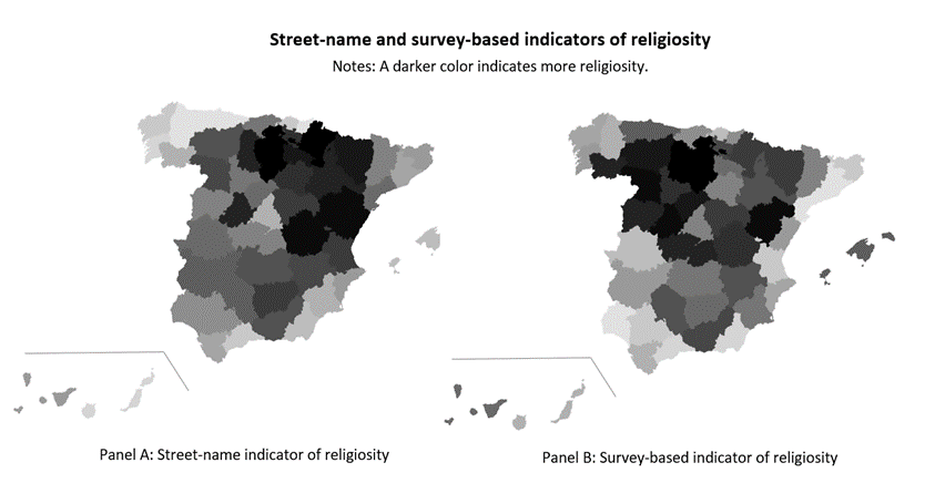
In the aforementioned article, we focus on measuring the religiosity level of municipalities. To do this, we create an indicator that measures the percentage of streets with religious names with respect to the total number of streets. Those with religious names can be identified by a list of words with religious meanings, such as “saint”, “virgin”, etc. The proportion of religious streets is approximately 12% on average in Spanish municipalities. Does this indicator reflect the religiosity of the population? The answer is affirmative: using province-level values, the correlation between this indicator and the percentage of people who attend religious services is slightly higher than 50%. The following map graphically shows this correlation.
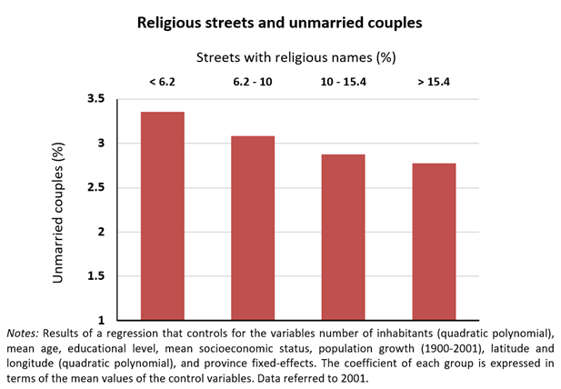
Testing the previous correlation at the municipality level is not easy due to lack of data on the religiosity of the population. In the article we use as variables related to religiosity at the local level the ratio of separated and divorced to married people, and the percentage of unmarried couples. When performing the analysis, we take into account differences in variables such as the number of inhabitants and the educational and socioeconomic level of the population, and we use only intra-province variation. Interestingly, the street-name indicator of religiosity is negatively and significantly related to both the incidence of separation and divorce and unmarried couples. Thus, for example, municipalities with a higher percentage of religious streets have, on average, a lower percentage of de facto couples (“living in sin”). The relationship between both variables is shown in the following graph.
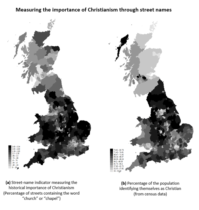
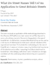
Finally, we have also applied this methodology to another country. In a short article, we analyze the street map of Great Britain, which also has about 900,000 streets. We show that the correlation (at the constituency level) between a measure of Christian-related street names and the percentage of the population identifying themselves as Christian is 44%, as illustrated in the following image.
For more details on the methodology and results, see the full articles:

Main article:
Oto-Peralías, Daniel. 2018. What Do Street Names Tell Us? The ‘City-Text’ as Socio-Cultural Data. Journal of Economic Geography, 18 (1): 187–211.
Application to Great Britain:
Oto-Peralías, Daniel. 2017. What Do Street Names Tell Us? An Application to Great Britain’s Streets. Available at SSRN: http://dx.doi.org/10.2139/ssrn.3063381.